Your Town by Foot, Car and Phone
Prior to the beginning of the COVID-19 Pandemic, my wife Marsha Baker and I started a project to correct a problem we found when visiting many places as tourists: Self-guided walking tours were hard to find.
When we found them, they were out of date and very limited — editorially and visually unacceptable.
So, we decided to fix the problem by creating an excellent set of walking tours for our hometown, Lexington, Massachusetts. We also hoped to set an example and build a system that could be used by others to create similar tours for places they care about.
Like the engineer I am, I started with the requirements: Our walking tours had to be attractive, informative, easy, and fun, utilizing the latest ways of conveying information and ubiquitously available. That meant smartphones and multimedia — a walking tour “app.”
I was capable of writing advanced computer programs, but I wanted to find an authoring system that would enable knowledgeable volunteers to create walking (or driving) tours of their town without material expense or advanced technical skills. The Johnny Appleseed in me wanted to make Marsha’s and my effort easily copyable by others. I imagined a movement where public-spirited residents show pride in their towns by providing visitors with high-quality, self-guided tours of the special things they would want visitors to see and/or know.
Marsha and I each have our specialties. Marsha is very involved in the Lexington Historical Society and is an expert on Lexington’s history from its founding in 1713 until today. (There is a lot more to Lexington than April 19, 1775, the first battle of the American Revolution!) She wanted to do this project — but was concerned about how to create, publicize, and distribute these tours to visitors.

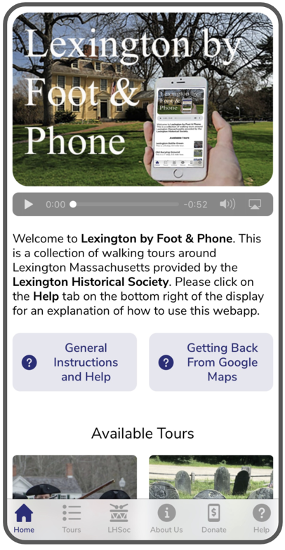
My area of interest is computers and networks. My assignment was to find an easy, cheap way to create a smartphone app that would deliver a superior experience: unlimited color photos, audio narration, and interactive maps guiding you to a point of interest.
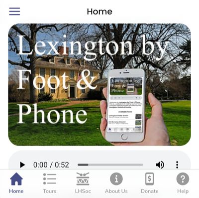
A creative friend, Carla Fortmann, suggested the name Lexington by Foot and Phone.
Armed with a good name, a history buff (Marsha), and a technology fanatic (me), we had a great project to keep us busy going into the COVID-19 lockdown.
Steps to Creating a Collection of Walking Tours

The first order of business was to decide what tours we were going to create. There were already several printed, text-heavy, self-guided walking tours that people at the Visitors Center might find in the back of some drawer (on a good day).
Also, the Lexington Historical Society had already created audio walking tours of the Battle Green and the Old Burying Ground in about 2010, but the logistics of handing out audio wands to people in exchange for their driver’s license cut down on the enthusiastic adoption of these tours. COVID-19 and concern for preventing the spread of viruses was the final nail in the coffin of the audio wand device. But the audio content was quite good and could be reused.
In the end, we planned for seven initial tour and configured a tour-making authoring system so that each tour could be created, expanded and updated easily.
For the authoring ystem, I found an excellent, free, smartphone-app development platform called Glide. It used a “no-code” approach so I didn’t need to use my programming skills. Bottom line: we were successful (I think) in creating a system that even a technical layman can use to create a lovely experience for visitors.
Are YOU interested in doing a similar thing for your town (or other area of interest)?
Creating a tour is an excellent way to collect and present the knowledge you have built up over the years about your town or interest and make it available to others. (It’s also a great way to learn more about an area, something I discovered creating these tours after living in Lexington for 40 years!) Done well, this can be a very nice “pay it forward” legacy you leave for future generations.
Offer For Creation
At this stage, the authoring system is still “beta” — not polished enough to release for general use. So, I’m looking for civic-minded volunteers willing to work with me and this beta version to create the tour YOU want to offer. With you providing the content and me supporting the authoring system, we can create a final version. If all goes as planned, you will not only create a tour for your town or interest but help me polish the authoring tool for use by future volunteers.
If you do this, here’s what you’ll need to do:
- Decide on the actual tour(s) to offer, what “stops” or points of interest are on the tour, and the pictures, video, audio and text you want to share about each stop (or the spaces between stops). I’ll be happy to offer advice on what makes good content — e.g., you don’t want to be too long-winded about any one stop.
- Upload the text, pictures and any audiovisual materials related to each stop of a tour.
- Use Google maps and my checklist to determine the latitude and longitude of each stop.
- Follow a recipe (and give me feedback) to assemble and publish the walking tour(s). This process is not fully automated yet. Based on your experience, I’ll move toward automating everything for later tour creators.
The result will be YOUR tour(s), fully completed, hosted (for free) on the Glide platform and ready to go like Lexington by Foot and Phone.
Distribution
If a tree falls in a forest and no one is there, … who cares? If you create an app and no one knows about it, you’ve wasted time. So, how do you make the world aware of your app? How do you make sure it gets used?
We partnered with the Lexington Historical Society. That solved our problem, because they publicized and promoted the app and the tours. (If you google “by foot and phone,” you’ll see all the places they have publicized it.) So, that’s the easiest way to proceed: find some local historical society, visitors bureau, chamber of commerce, public library or similar organization to “sponsor” you.
Note: we developed this as a FREE walking tour, and I do think that’s the way to go. Yes, we did bolt on a “donation” link for the Lexington Historical Society at the end of every tour, and that does get used. Frankly, that’s another good reason for the Historical Society to promote our app. While creating tours using a for-profit business model is done, that’s not what our system creates.
If you don’t have sponsorship from some civic organization, you can “market” the app yourself by announcing it on Tripadvisor, Google, Yelp and travel sites covering your area. They will be very eager to list you in their “activities” pages as “interesting things to do.”
Contact Me
Let’s do one, OK? What areas are of interest to you? If you are interested in doing it … or just learning more, contact me (harry@forsdick.com), and we’ll go from there.